POV-Ray Program by Jay Tanner - 2025
Charts and Diagrams
Using special maps, you can create color-coded lunar renderings showing such
things as gravity distribution, crustal thickness and surface features altimetry.
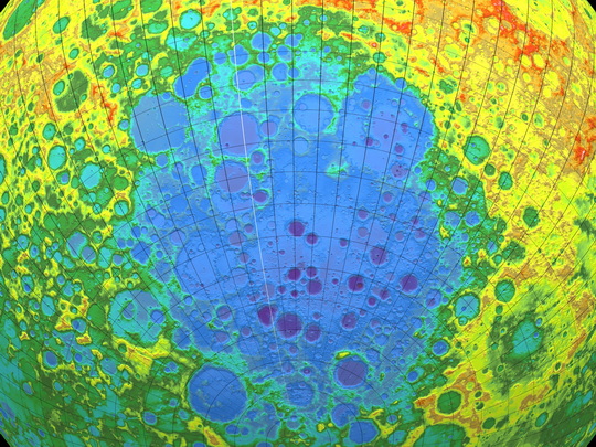
Color-coded altimetry of the Aitken Basin in the southern hemisphere of the
far side of the moon. It is the largest known impact crater on the moon.
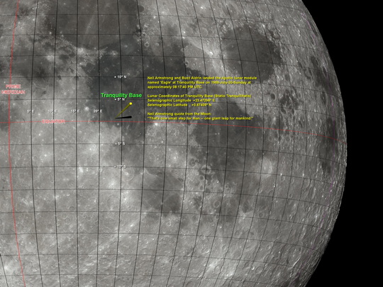
Rendering of Tranquility Base - Location of first human footprint on the moon
A simple image editor can be used to add any desired text after rendering.
In this case, an old version of Paintshop Pro running on Windows XP was used.
Using special maps, you can create color-coded lunar renderings showing such
things as gravity distribution, crustal thickness and surface features altimetry.
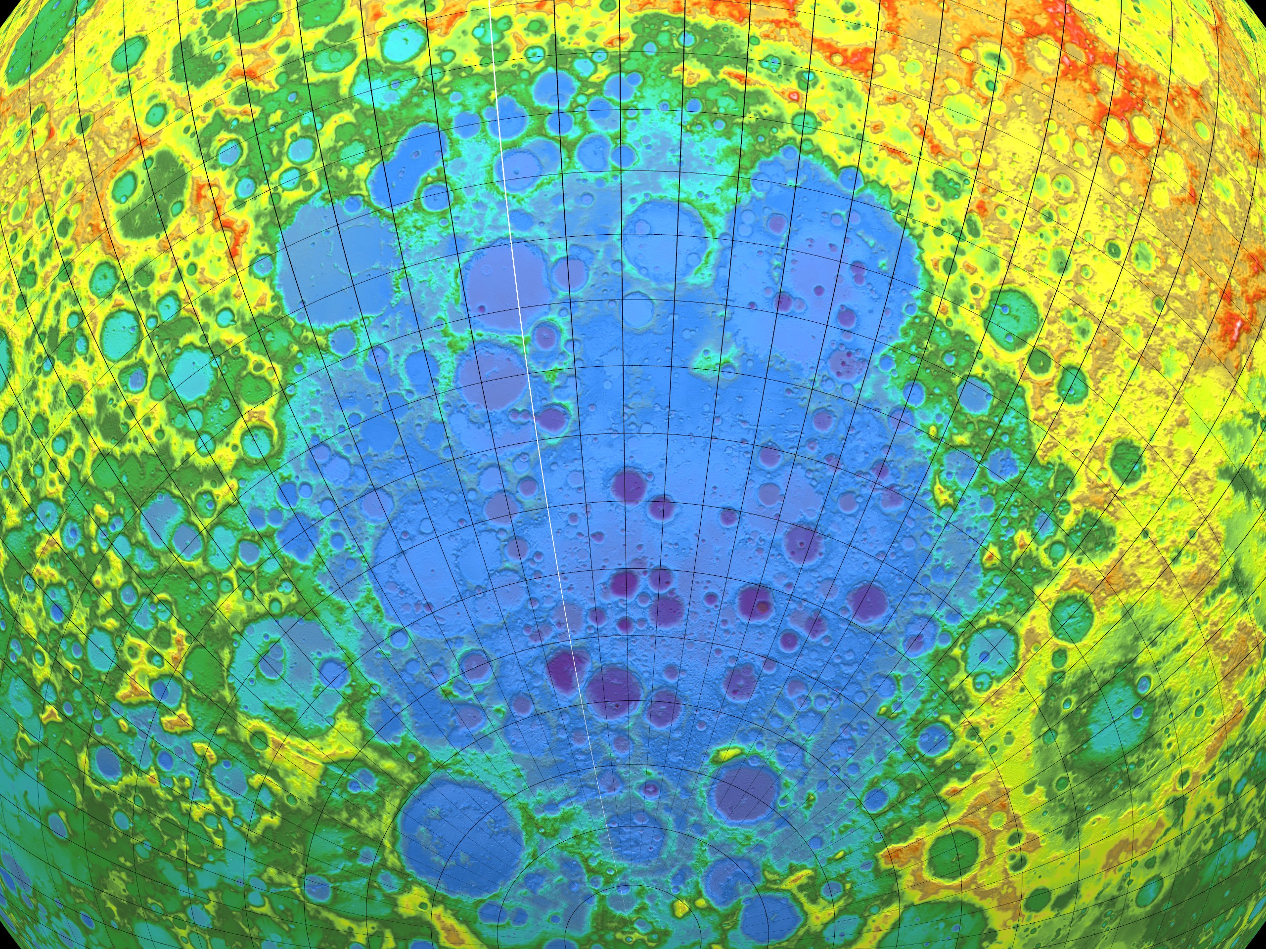
Color-coded altimetry of the Aitken Basin in the southern hemisphere of the
far side of the moon. It is the largest known impact crater on the moon.
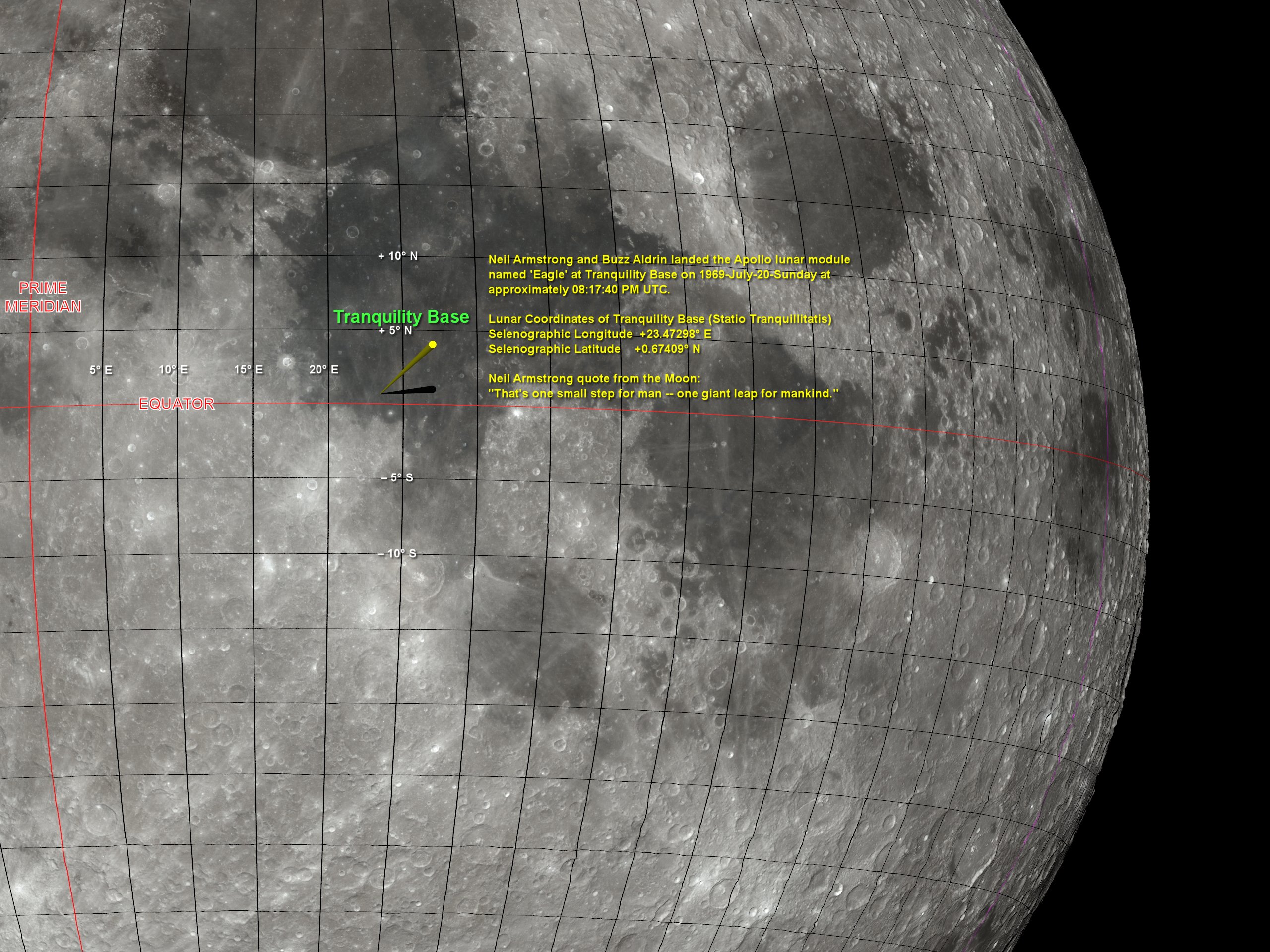
Rendering of Tranquility Base - Location of first human footprint on the moon
A simple image editor can be used to add any desired text after rendering.
In this case, an old version of Paintshop Pro running on Windows XP was used.
LUNEX can be used to create customized lunar maps and charts made to order for educational or other applications using various texture maps. However, LUNEX only generates images, but any simple graphics image editor can be used to add any desired text or labels after rendering.
LUNEX can simulate a telescopic view of the moon as viewed from Earth or it can simulate a view of the moon as it might be viewed from an orbiting spacecraft by moving the camera to another location in space.
LUNEX can view the entire surface of the moon from virtually any perspective and phase illumination, even the hidden far-side and polar regions.
View More LUNEX Rendering Examples